Two-Sided Essential Classroom Map of France with Updated Regions
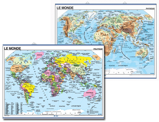
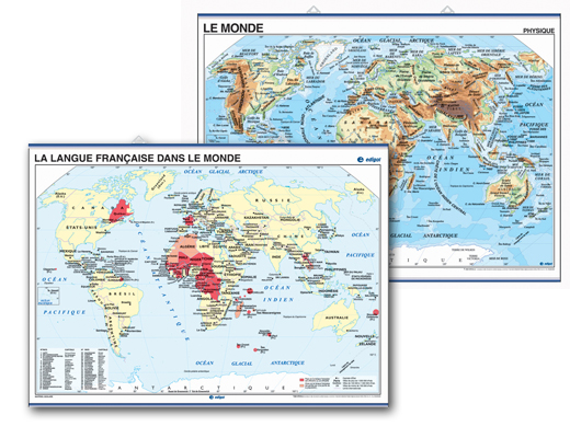
The French map of France reflects the "New Territory Organization." This colorful, two-sided wall map features physical characteristics on one side and political information on the other. Physical side shows mountain ranges, lakes, rivers and other geographical features. Political side shows capitals, principal cities, and towns. Its travel-friendly form is easily rolled and taken from room to room.
All levels. All text in French. 36 x 46 inches. Matte, durable, flexible, wipeable, lightweight vinyl.
Write a review
New French Regions Map
Aug 17, 2017 | By Shane Strickland


Great resource for the French classroom. Fully updated with new regions in popping colors.
Very nice - just one small error
Aug 26, 2017 | By James


This is a beautiful map, which I plan to display in my classroom. I like that it shows the names and numbers of each of the departments of France. There is just one small error - the island of Mayotte is listed as an overseas territory, when in 2011 its status was changed to that of an overseas department. Otherwise it is great.
Staff's Response: Thanks for the review James. We apologize for the error and appreciate you bringing this to our attention. We will share your comment with the distributor. Great to hear you are pleased with the map! Thanks again.
Excellent visual
Mar 11, 2022 | By Rebekah


I love my map. It's exactly what I needed to reference during class. I love that it's two-sided too. The hooks are strong and I attached it to the wall using command hooks. So easy! So bright and cheery!

